Hilton Head Island
FEATURE
SEASON 2 · EPISODE 1 · JUNE 2026
Photography and story by John Menzies; Updated in September 2026
What You Don't See
Most people know Hilton Head Island for its beaches, its golf, and a particular kind of unhurried calm.
But on the north end of the island, there was once a small town called Mitchelville.
It had elected officials. A school board. Organized streets. Residents who owned their homes, made their own laws, and enforced them.
Elsewhere, those details might have described an ordinary town.
But twelve months earlier, not one of its residents had been legally allowed to own anything. Under the laws of South Carolina, the people themselves were property.
And then, in the span of a single afternoon, everything changed. Here. On this island. In 1861. Because of a naval battle that lasted a few hours and that almost no one today has heard of.
Port Royal Sound, seen from Hilton Head Island’s north end. Today, the broad stretch of water gives little indication of what happened here more than 160 years ago.
The Battle
On the morning of November 7, 1861, one of the largest naval expeditions in American history to that point sailed into Port Royal Sound, just off the northern end of Hilton Head Island.
The harbor entrance was guarded by two Confederate forts — Fort Beauregard to the north, Fort Walker to the south on Hilton Head itself. They had been built to stop exactly this kind of assault. They were not built for what Flag Officer Samuel Du Pont did next.
Du Pont ordered his ships to keep moving, forming an ellipse in the channel. Each ship fired on the Confederate forts in turn, then circled back and fired again — presenting the gunners with a moving target they had no answer for. It was a tactic that had never been tried at this scale.
It worked.
By early afternoon, Confederate troops had abandoned Fort Walker. Fort Beauregard was evacuated shortly afterward and both forts were now in Union hands.
The Confederate commanders fled toward Beaufort. The white planters who had built their world on this island turned and ran with them.
They left so fast they left everything behind.
Thousands of enslaved people were left behind across Hilton Head and the surrounding islands.
They were Black Americans — men, women, and children whose ancestors had been brought by force from West Africa and enslaved on these islands for generations.
Who did not run.
Who stayed.
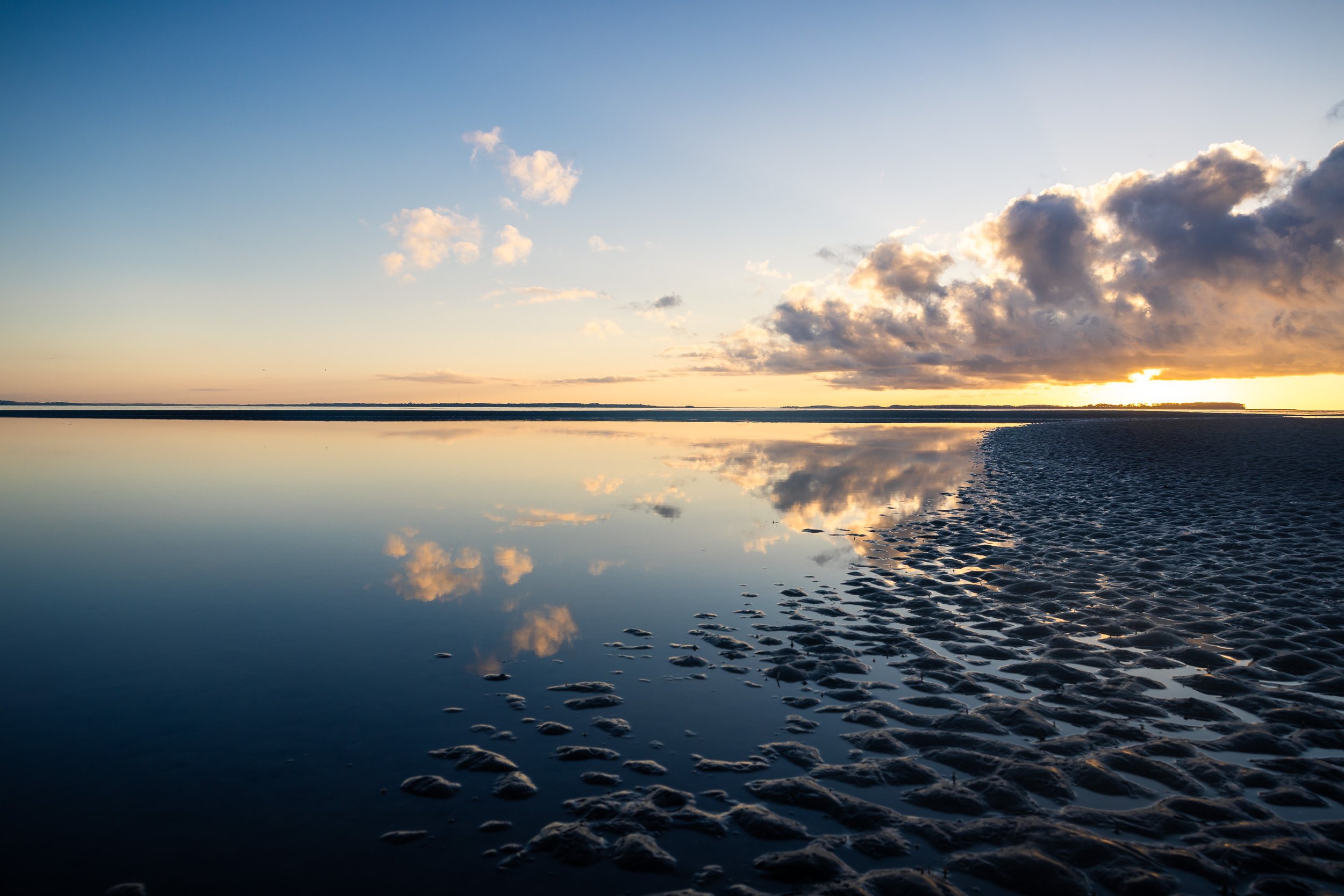
Sunrise over Port Royal Sound. It’s difficult to reconcile water this calm with the battle that unfolded here on November 7, 1861.
What They Built
The Union now controlled the island. Freed people began arriving at the encampment almost immediately. Then by the hundreds. The army was quickly overwhelmed.
When Union Major General Ormsby Mitchel arrived in September 1862 and saw the conditions, he directed the building of a village — by and for the freed people themselves. Homes were built on quarter-acre lots.
The town was named Mitchelville in his honor. Mitchel died of yellow fever before it was finished and never saw what it became.
The people who lived there kept building.
Ghosted Structure representing the First African Baptist Church — Historic Mitchelville Freedom Park
Ghosted Structures — Historic Mitchelville Freedom Park
Within months, residents had established houses and businesses, churches and schools, and their own government. People from surrounding islands came too, eventually creating a town with around 500 houses and a population of between 1,500 and 3,000 people.
Mitchelville enacted the first compulsory education law in South Carolina — requiring every child between six and fifteen to attend school. Not just formerly enslaved children. Every child.
It was the first self-governed town of formerly enslaved people in the United States.
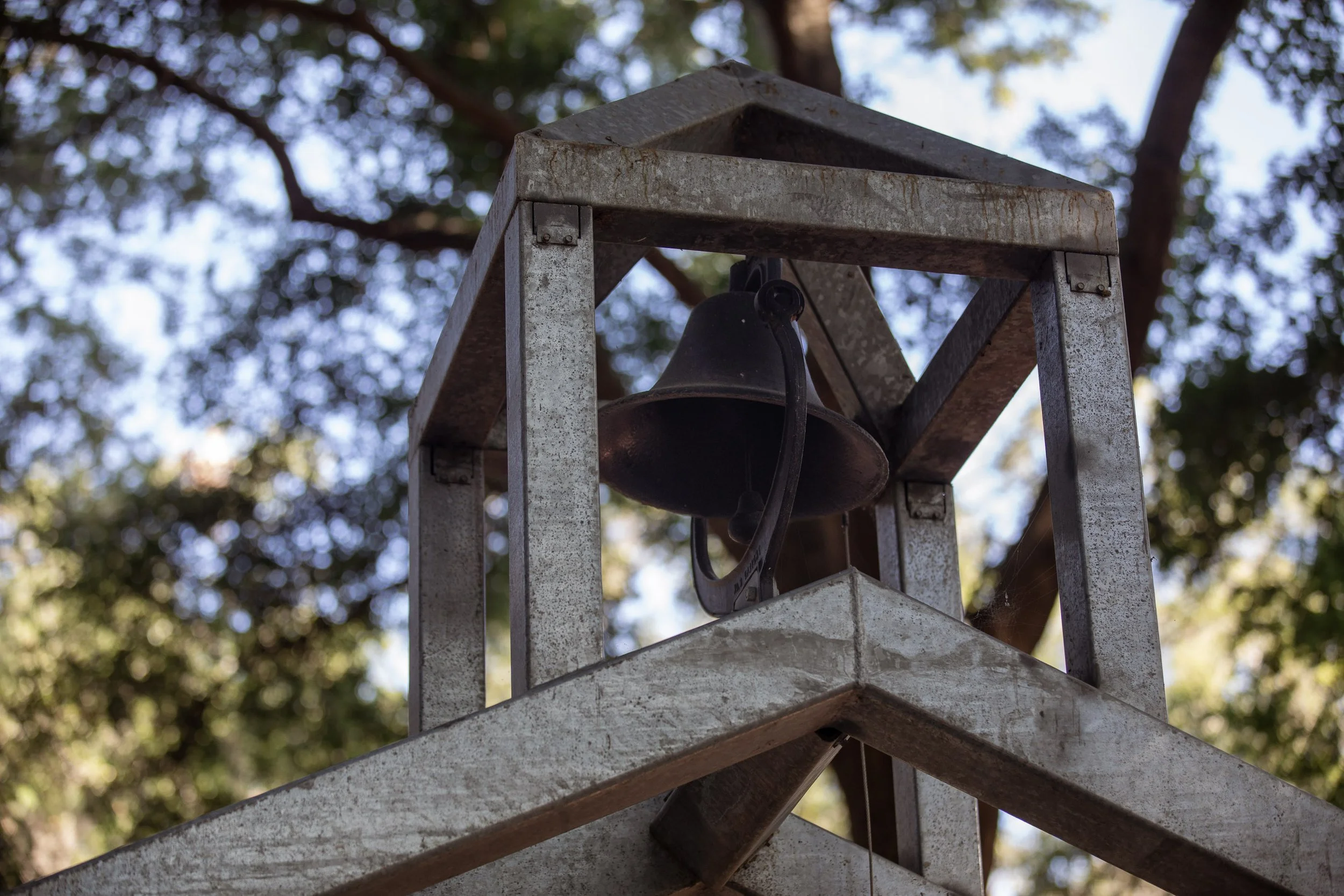
Ghosted Structure of the bell tower of the First African Baptist Church — Historic Mitchelville Freedom Park. Founded in 1862 with 120 members
Founded before the Emancipation Proclamation. Before the war ended. Before anyone had formally agreed that the people who built it had the right to build anything at all.
After the war, the land promised to its residents was gradually taken back. Former plantation owners returned. The town dispersed. By the 1880s it was gone. The physical structures were lost to hurricanes, time, and development.
The ground remained. And for most of the next century, almost no one knew what had happened on it.
The Ghosted Structures—steel-beam outlines of the homes that once stood here—only went up in June 2024. An archaeological research facility broke ground in August 2025. A $22.8 million restoration is now underway.
The story of Mitchelville is only just beginning to find its way back to the surface.
Nearly a century after the town disappeared, Hilton Head was about to change again.
Not in the same way. Not for the same reasons.
This transformation began with a developer named Charles Fraser and an unusual idea for the 1950s:
What shouldn't we build here?
The Decision to Hold Back
Fraser's father bought 5,000 acres at the southern end of the island for timber harvesting. Every tree on it was meant to be cut down.
Fraser took over the land and built something else entirely.
At Sea Pines — his master-planned resort community — he created rules that were unusual for coastal development at the time. Roads curved around trees instead of cutting through them.
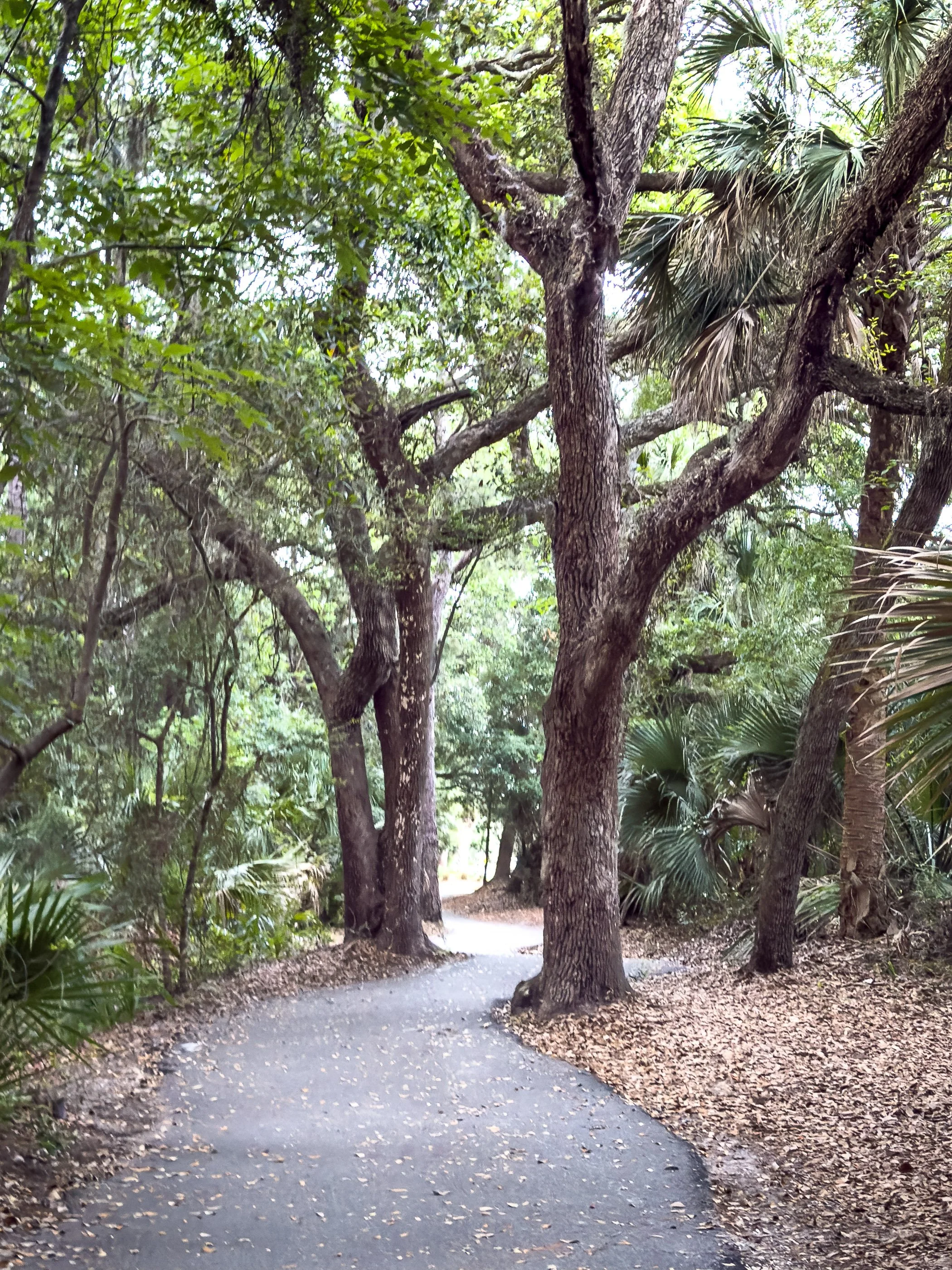
A bike path, Sea Pines Resort, Hilton Head Island.
Buildings stayed low — nothing rising above the canopy. Signs were minimal, understated, nearly invisible.
Even McDonald's follows the rules.
Island Crossing shopping center. Fraser's architectural guidelines required commercial signage to be understated and discovered rather than advertised.
The marshes and ancient oaks weren't obstacles to work around. They were the point.
What Fraser understood — decades before much of the development world caught up — was that the value of Hilton Head wasn't what you could put on it. It was what was already there. Every building that blocked a marsh view destroyed the very thing people were coming to see.
A salt marsh on Hilton Head Island’s north end. Views like this remain part of the island’s character, in part because Fraser’s work at Sea Pines established a model for building around Hilton Head’s marshes, trees, and waterways.
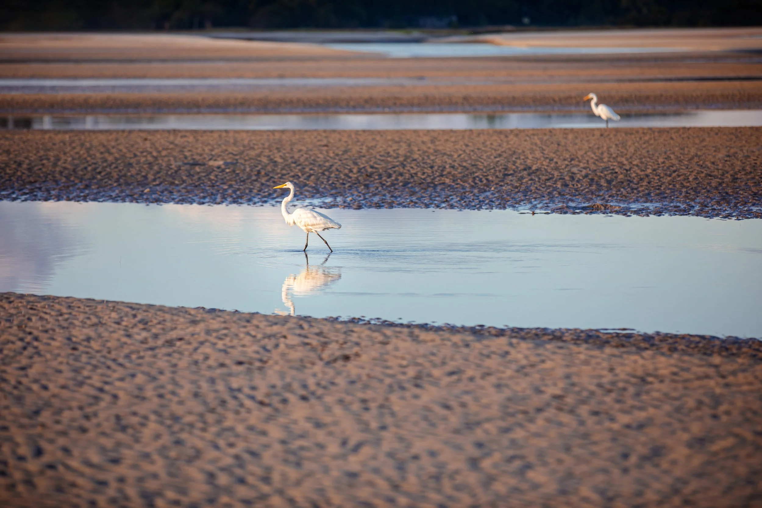
Great egrets wade along Fish Haul Beach at the edge of Port Royal Sound. The wildlife and marshland that feel inseparable from Hilton Head today are part of the landscape Fraser believed development should protect, not replace.
Visitors might reasonably assume those rules came from environmental laws. Most of them started as private decisions.
He believed the island was enough. And he protected it like he meant it.
A common sight on the island — roads and dedicated bike paths, side by side.
Sea Pines became the model for master-planned communities across America — from Florida to California. Developers who came after him had a playbook. Fraser wrote it from scratch.
Fraser died in 2002. He is buried in Sea Pines — under the Liberty Oak, a tree his company saved by redesigning the resort's entire marina basin at considerable expense because someone found it growing in the way.
He's buried under a tree. On an island full of trees he refused to cut down.
How It Feels
What Fraser built is something that's easy to experience and harder to explain.
You drive under a canopy of live oaks, Spanish moss hanging just low enough to soften the light, and the island reveals itself slowly — by design. No buildings rising above the trees. No bright signs competing for attention. The places you're trying to find stay just out of view until the last possible moment.
Sea Pines Resort. A live oak canopy so dense that nothing built here rises above it.
You notice it when you're riding a bike and the path disappears into a tunnel of trees. When you're walking to the beach and the access path slowly reveals the ocean as you emerge from the dunes.
The dunes at the edge of the Atlantic. The tall grass is sea oats — their roots anchor the dunes against erosion. Removing them is prohibited by South Carolina law.
Hilton Head's tides swing six to eight feet twice a day. At low tide the ocean pulls back and leaves this behind.
Nothing insists on being seen.
End of day on Hilton Head. The calm the island is known for.
Worth Uncovering
The roads curve. The signs stay low. The trees still meet overhead.
Fraser’s decisions at Sea Pines helped create the Hilton Head visitors recognize.
But the deeper American story began nearly a century earlier.
Here, people who had been property built a town of their own. They elected leaders. Opened schools. Wrote laws. Made homes.
Then their town disappeared.
And now it is being found again.
Historic Mitchelville Freedom Park. The Ghosted Structures were unveiled in June 2024. An archaeological research facility broke ground on the same site in August 2025.
I visited what is known today as the Historic Mitchelville Freedom Park at seven thirty in the morning. Construction crews were already working on the new Archaeological Research Facility. On the other side of the park, an active excavation was underway — archaeologists already pulling the ground apart, looking for what's still down there.
The story of America's first self-governed town of freed people is not just being remembered. It's being actively dug up.
Just out of sight from the golf and the beaches.
That particular kind of unhurried calm is still here. What you don't notice is everything that was done — and everything that wasn't — to create it.
And that is the story behind the place.
Author’s Note: This story was reviewed and updated in September 2026 as part of the launch of Story Behind The Place as an independent website. The update includes factual corrections clarifying that Fort Beauregard was abandoned rather than surrendered and that representations of Mitchelville were already present before the Ghosted Structures were unveiled in 2024; it also refines the story’s historical framing, photographic captions, and conclusion.
THE STORY CONTINUES
Get the next Story Behind The Place delivered to your inbox each month.
KEEP EXPLORING THIS PLACE
See the complete photography collection, including photographs that didn't appear in the story and selected images available as prints.